Birding Hike at Carver Park Reserve
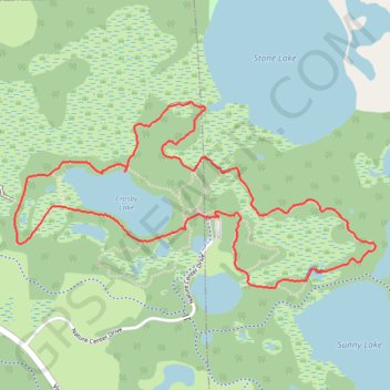
Loop hike from Lowry Nature Center via Maple Trail, Dragon Fly Pond, Sunny Lake, Lake Zumbra, Oak Trail, Aspen Trail, Crosby Lake and Tamarack Trail in the Carver Park Reserve. #Hiking #Loop #Nature #Park #Forest #Lake
- Distance: 5.5 Km
- Elevation gain: 50 m
- Maximum elevation: 300 m
- Elevation loss: 50 m
- Minimum elevation: 287 m
- Moving time: 1 h 25 m
- Moving speed: 3.8 Km/h
- Maximum speed: 5.7 Km/h
- Total time: 1 h 46 m
- Global speed: 3.1 Km/h
Interactive trail map
Trail profile
- Distance: 5.5 Km
- Elevation gain: 50 m
- Maximum elevation: 300 m
- Elevation loss: 50 m
- Minimum elevation: 287 m
- Moving time: 1 h 25 m
- Moving speed: 3.8 Km/h
- Maximum speed: 5.7 Km/h
- Total time: 1 h 46 m
- Global speed: 3.1 Km/h
About this trail
Name: Birding Hike at Carver Park Reserve trail, distance, elevation, map, profile, GPS track
Coordinates: 44.87935 -93.69399 44.88692 -93.67331
Other hiking, mountain biking, running and outdoor activity trails
Click on a trail to view its statistics, map and profile.
Crosby Lake Loop via Lake Trail and Tamarack Trail
United States > Minnesota > Carver County > Laketown Township
Distance: 3.1 Km • Elevation gain: 16 m • Maximum elevation: 299 m
Aspen Trail and Tamarack Trail loop around the Crosby Lake
United States > Minnesota > Carver County > Laketown Township
Distance: 3.2 Km • Elevation gain: 23 m • Maximum elevation: 300 m
Maple Trail - Carver Park Reserve
United States > Minnesota > Carver County > Victoria
Distance: 2.3 Km • Elevation gain: 21 m • Maximum elevation: 298 m