Import a GPX file

North Fork American River via Stevens Trail

Tahoe National Forest. #Hiking #River #Forest #Mountain #Forest #Waterfall #Nature #Tahoe

  • Distance: 12.4 Km
  • Elevation gain: 648 m
  • Maximum elevation: 726 m
  • Elevation loss: 648 m
  • Minimum elevation: 373 m

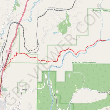
Interactive trail map

Trail profile

  • Distance: 12.4 Km
  • Elevation gain: 648 m
  • Maximum elevation: 726 m
  • Elevation loss: 648 m
  • Minimum elevation: 373 m

About this trail

Name: North Fork American River via Stevens Trail trail, distance, elevation, map, profile, GPS track

Start: Stevens Trail Parking Lot, Stevens Trail, Placer County, California, 95713, United States (39.10545 -120.94736)

End: Stevens Trail Parking Lot, North Canyon Way, Colfax, Placer County, California, 95713, United States (39.10545 -120.94736)

Coordinates: 39.10545 -120.94736 39.11732 -120.89667

Gear up for your next adventure:

🧣Merino Neck Gaiter - Protects against wind, sun, and cold at high altitudes
🧶550 Survival Paracord - Versatile utility cord for emergency repairs and rigging
🧢Sun Hat - Wide-brim hat for sun protection
🗺️Topographic Maps - Detailed maps to explore trails, mountains, and wilderness areas
🧢Sun Protection Cap - Breathable cap to protect from sun exposure

As an Amazon Associate, this site earns from qualifying purchases at no extra cost to you.