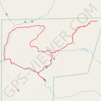
Clark Creek Improved Loop Trail
The Clark Creek Improved Loop Trail is a scenic destination known for its beautiful waterfalls and diverse landscapes. As you hike, you'll encounter well-maintained gravel paths, wooden bridges, and stairways, making it accessible for hikers of all levels while providing opportunities to observe local wildlife and enjoy the lush surroundings. #Hiking #Loop #Waterfall #Forest #Nature
- Distance: 4.7 Km
- Elevation gain: 120 m
- Maximum elevation: 130 m
- Elevation loss: 111 m
- Minimum elevation: 48 m
- Moving time: 1 h 35 m
- Moving speed: 2.9 Km/h
- Maximum speed: 8.2 Km/h
- Total time: 2 h 58 m
- Global speed: 1.6 Km/h
Interactive trail map
Trail profile
- Distance: 4.7 Km
- Elevation gain: 120 m
- Maximum elevation: 130 m
- Elevation loss: 111 m
- Minimum elevation: 48 m
- Moving time: 1 h 35 m
- Moving speed: 2.9 Km/h
- Maximum speed: 8.2 Km/h
- Total time: 2 h 58 m
- Global speed: 1.6 Km/h
About this trail
Name: Clark Creek Improved Loop Trail trail, distance, elevation, map, profile, GPS track
Start: (u), Wilkinson County, Mississippi, United States (31.07135 -91.51241)
Coordinates: 31.06454 -91.52464 31.07175 -91.51141
Other hiking, mountain biking, running and outdoor activity trails
Click on a trail to view its statistics, map and profile.
Clark Creek Improved Trail in Clark Creek Natural Area
United States > Mississippi > Wilkinson County
The Clark Creek Improved Trail offers a delightful hiking experience through lush woodlands and picturesque landscapes. As you traverse the well-maintained paths, you'll encounter numerous cascading waterfalls, which are particularly stunning after rainfall. The trail's accessibility, with gravel paths and…
Distance: 4.9 Km • Elevation gain: 137 m • Maximum elevation: 130 m
Clark Creek Primitive Loop Trail in Clark Creek Natural Area
United States > Mississippi > Wilkinson County
The Clark Creek Primitive Loop Trail offers a rewarding hike through dense hardwood forests and rugged terrain, punctuated by a series of cascading waterfalls. As you navigate steep hills and cross over boulder-strewn creeks, the scenic beauty of loess bluff formations and shaded groves adds to the trail's…
Distance: 7.1 Km • Elevation gain: 210 m • Maximum elevation: 129 m