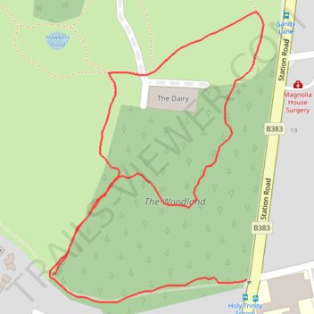
Sunningdale Park Woodland Path
- Distance: 1.2 Km
- Elevation gain: 14 m
- Maximum elevation: 66 m
- Elevation loss: 11 m
- Minimum elevation: 57 m
- Moving time: 14 m 2 s
- Moving speed: 5.3 Km/h
- Maximum speed: 9.0 Km/h
- Total time: 14 m 2 s
- Global speed: 5.3 Km/h
Interactive trail map
Trail profile
- Distance: 1.2 Km
- Elevation gain: 14 m
- Maximum elevation: 66 m
- Elevation loss: 11 m
- Minimum elevation: 57 m
- Moving time: 14 m 2 s
- Moving speed: 5.3 Km/h
- Maximum speed: 9.0 Km/h
- Total time: 14 m 2 s
- Global speed: 5.3 Km/h
About this trail
Name: Sunningdale Park Woodland Path trail, distance, elevation, map, profile, GPS track
Coordinates: 51.39768 -0.63827 51.40070 -0.63471