Mineral Creek Falls via Hoh River Trail in Olympic National Park
The Hoh River Trail to Mineral Creek Falls offers hikers a serene journey through the lush, moss-draped rainforest of Olympic National Park. Along the way, the trail meanders beside the glacial blue Hoh River, providing tranquil views of its clear waters. Upon reaching Mineral Creek Falls, hikers are treated to the sight of a picturesque waterfall cascading over moss-covered rocks, set against the backdrop of the dense, green forest. #Hiking #Mountain #Forest #Nature #Waterfall #River
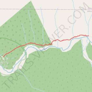
- Distance: 8.8 Km
- Elevation gain: 245 m
- Maximum elevation: 243 m
- Elevation loss: 245 m
- Minimum elevation: 187 m
- Moving time: 2 h 14 m
- Moving speed: 3.9 Km/h
- Maximum speed: 8.0 Km/h
- Total time: 2 h 19 m
- Global speed: 3.8 Km/h
Interactive trail map
Trail profile
- Distance: 8.8 Km
- Elevation gain: 245 m
- Maximum elevation: 243 m
- Elevation loss: 245 m
- Minimum elevation: 187 m
- Moving time: 2 h 14 m
- Moving speed: 3.9 Km/h
- Maximum speed: 8.0 Km/h
- Total time: 2 h 19 m
- Global speed: 3.8 Km/h
About this trail
Name: Mineral Creek Falls via Hoh River Trail in Olympic National Park trail, distance, elevation, map, profile, GPS track
Start: Mini Trail, Jefferson County, Washington, United States (47.86046 -123.93434)
End: Mini Trail, Jefferson County, Washington, United States (47.86051 -123.93438)
Coordinates: 47.86046 -123.93438 47.86912 -123.88445
Other hiking, mountain biking, running and outdoor activity trails
Click on a trail to view its statistics, map and profile.
Spruce Nature Trail and Hall of Mosses Trail Loop in Olympic National Park
United States > Washington > Jefferson County
The Spruce Nature Trail and Hall of Mosses Trail Loop in Olympic National Park offers a delightful journey through one of the finest examples of temperate rainforest in the U.S. As you wander along the well-maintained paths, you'll be surrounded by towering old-growth trees draped in vibrant mosses, creating a…
Distance: 3.5 Km • Elevation gain: 67 m • Maximum elevation: 220 m