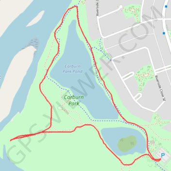
Carburn Park Pond Loop
Interactive trail map
Trail profile
- Distance: 2.3 Km
- Elevation gain: 12 m
- Maximum elevation: 1,025 m
- Elevation loss: 12 m
- Minimum elevation: 1,018 m
About this trail
Name: Carburn Park Pond Loop trail, distance, elevation, map, profile, GPS track
Start: Carburn park connector, Riverbend, Calgary, Alberta, T2C 3R3, Canada (50.97358 -114.02616)
End: Carburn park connector, Riverbend, Calgary, Alberta, T2C 3R3, Canada (50.97356 -114.02616)
Coordinates: 50.97335 -114.03521 50.97934 -114.02616
Topography: Calgary topographic map, elevation, terrain