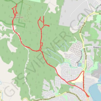
Mount Wongawallan
- Distance: 19.3 Km
- Elevation gain: 870 m
- Maximum elevation: 365 m
- Elevation loss: 870 m
- Minimum elevation: 7 m
- Moving time: 2 h 53 m
- Moving speed: 6.7 Km/h
- Maximum speed: 16.6 Km/h
- Total time: 3 h 55 s
- Global speed: 6.4 Km/h
Interactive trail map
Trail profile
- Distance: 19.3 Km
- Elevation gain: 870 m
- Maximum elevation: 365 m
- Elevation loss: 870 m
- Minimum elevation: 7 m
- Moving time: 2 h 53 m
- Moving speed: 6.7 Km/h
- Maximum speed: 16.6 Km/h
- Total time: 3 h 55 s
- Global speed: 6.4 Km/h
About this trail
Name: Mount Wongawallan trail, distance, elevation, map, profile, GPS track
Coordinates: -27.89875 153.25293 -27.86389 153.28552