Folkestone Park Run
- Distance: 5.0 Km
- Elevation gain: 38 m
- Maximum elevation: 47 m
- Elevation loss: 38 m
- Minimum elevation: 30 m
- Moving time: 31 m 7 s
- Moving speed: 9.7 Km/h
- Maximum speed: 13.2 Km/h
- Total time: 31 m 7 s
- Global speed: 9.7 Km/h
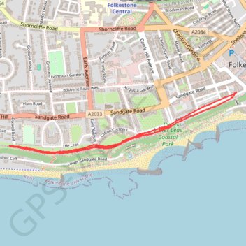
Interactive trail map
Trail profile
- Distance: 5.0 Km
- Elevation gain: 38 m
- Maximum elevation: 47 m
- Elevation loss: 38 m
- Minimum elevation: 30 m
- Moving time: 31 m 7 s
- Moving speed: 9.7 Km/h
- Maximum speed: 13.2 Km/h
- Total time: 31 m 7 s
- Global speed: 9.7 Km/h
About this trail
Name: Folkestone Park Run trail, distance, elevation, map, profile, GPS track
Coordinates: 51.07421 1.15846 51.07758 1.17850
Other hiking, mountain biking, running and outdoor activity trails
Click on a trail to view its statistics, map and profile.
Folkestone
United Kingdom > England > Kent > Folkestone and Hythe District > Sandgate
Distance: 31.0 Km • Elevation gain: 248 m • Maximum elevation: 78 m