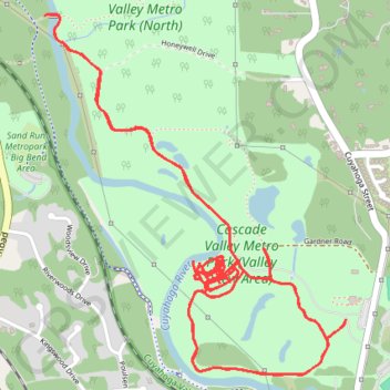
Cascade Valley Metro Park - Valley View Area
Akron Trail Running
- Distance: 9.8 Km
- Elevation gain: 75 m
- Maximum elevation: 246 m
- Elevation loss: 75 m
- Minimum elevation: 227 m
- Moving time: 57 m 30 s
- Moving speed: 10.2 Km/h
- Maximum speed: 13.4 Km/h
- Total time: 57 m 30 s
- Global speed: 10.2 Km/h
Interactive trail map
Trail profile
- Distance: 9.8 Km
- Elevation gain: 75 m
- Maximum elevation: 246 m
- Elevation loss: 75 m
- Minimum elevation: 227 m
- Moving time: 57 m 30 s
- Moving speed: 10.2 Km/h
- Maximum speed: 13.4 Km/h
- Total time: 57 m 30 s
- Global speed: 10.2 Km/h
About this trail
Name: Cascade Valley Metro Park - Valley View Area trail, distance, elevation, map, profile, GPS track
Coordinates: 41.12010 -81.53943 41.13286 -81.52528