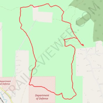
Scratchgravel Loop MTB
- Distance: 9.9 Km
- Elevation gain: 228 m
- Maximum elevation: 1,389 m
- Elevation loss: 228 m
- Minimum elevation: 1,292 m
- Moving time: 52 m 50 s
- Moving speed: 11.2 Km/h
- Maximum speed: 41.7 Km/h
- Total time: 1 h 23 m
- Global speed: 7.1 Km/h
Interactive trail map
Trail profile
- Distance: 9.9 Km
- Elevation gain: 228 m
- Maximum elevation: 1,389 m
- Elevation loss: 228 m
- Minimum elevation: 1,292 m
- Moving time: 52 m 50 s
- Moving speed: 11.2 Km/h
- Maximum speed: 41.7 Km/h
- Total time: 1 h 23 m
- Global speed: 7.1 Km/h
About this trail
Name: Scratchgravel Loop MTB trail, distance, elevation, map, profile, GPS track
Start: Scratch Gravels Doubletrack, Lewis and Clark County, Montana, United States (46.66791 -112.09503)
End: Scratch Gravels Doubletrack, Lewis and Clark County, Montana, United States (46.66786 -112.09498)
Coordinates: 46.65347 -112.11997 46.67921 -112.09483
Other hiking, mountain biking, running and outdoor activity trails
Click on a trail to view its statistics, map and profile.
Scratchgravel Hills Mountain Biking
United States > Montana > Lewis and Clark County
Distance: 14.0 Km • Elevation gain: 383 m • Maximum elevation: 1,433 m