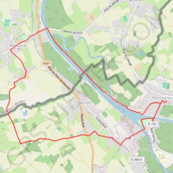
Randonnée : circuit des fraudeurs
- Distance: 9.8 Km
- Elevation gain: 43 m
- Maximum elevation: 36 m
- Elevation loss: 43 m
- Minimum elevation: 13 m
Interactive trail map
Trail profile
- Distance: 9.8 Km
- Elevation gain: 43 m
- Maximum elevation: 36 m
- Elevation loss: 43 m
- Minimum elevation: 13 m
About this trail
Name: Randonnée : circuit des fraudeurs trail, distance, elevation, map, profile, GPS track
Coordinates: 50.49600 3.41226 50.51603 3.45555