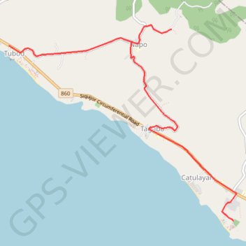
Lugnason Falls
- Distance: 9.5 Km
- Elevation gain: 159 m
- Maximum elevation: 144 m
- Elevation loss: 154 m
- Minimum elevation: 9 m
Interactive trail map
Trail profile
- Distance: 9.5 Km
- Elevation gain: 159 m
- Maximum elevation: 144 m
- Elevation loss: 154 m
- Minimum elevation: 9 m
About this trail
Name: Lugnason Falls trail, distance, elevation, map, profile, GPS track
Coordinates: 9.11853 123.50750 9.14939 123.54376