Import a GPX file

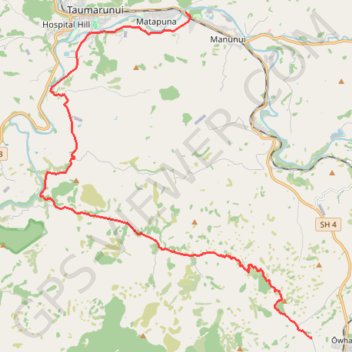
Taumarunui - Owhango

Whanganui River. #Bike #Road #River #Forest #Mountain #Nature

  • Distance: 28.0 Km
  • Elevation gain: 737 m
  • Maximum elevation: 488 m
  • Elevation loss: 474 m
  • Minimum elevation: 156 m

Interactive trail map

Trail profile

  • Distance: 28.0 Km
  • Elevation gain: 737 m
  • Maximum elevation: 488 m
  • Elevation loss: 474 m
  • Minimum elevation: 156 m

About this trail

Other hiking, mountain biking, running and outdoor activity trails

Click on a trail to view its statistics, map and profile.

Piropiro - Taumarunui

New Zealand > Manawatū-Whanganui > Ruapehu District

Pureora Forest. Ongarue River. #Bike #MTB #Countryside #Forest #River #Nature

Distance: 69.0 Km • Elevation gain: 1,050 m • Maximum elevation: 628 m

Gear up for your next adventure:

🍽️Titanium Camping Spork - Ultralight and indestructible eating utensil
🥾Waterproof Trail Shoes - Shoes designed to handle wet terrain
🧥Waterproof Hiking Jacket - Protect yourself from rain and wind while hiking
🧢Hiking Hat - Sun-protective and breathable hats for long treks
🧢Sun Protection Cap - Breathable cap to protect from sun exposure

As an Amazon Associate, this site earns from qualifying purchases at no extra cost to you.