Purple Mountain
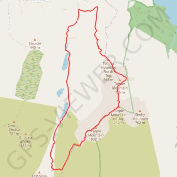
Interactive trail map
Trail profile
- Distance: 15.4 Km
- Elevation gain: 871 m
- Maximum elevation: 818 m
- Elevation loss: 870 m
- Minimum elevation: 47 m
About this trail
Name: Purple Mountain trail, distance, elevation, map, profile, GPS track
Start: Dunloe ED, Kenmare Municipal District, County Kerry, Munster, V93 E029, Ireland (52.04077 -9.63141)
Coordinates: 51.99460 -9.64484 52.04490 -9.60701
Other hiking, mountain biking, running and outdoor activity trails
Click on a trail to view its statistics, map and profile.
Purple Mountain
Distance: 15.4 Km • Elevation gain: 861 m • Maximum elevation: 818 m