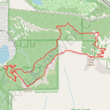
Rowton Peak and Crows Nest Loop from Serene Lakes
- Distance: 13.6 Km
- Elevation gain: 492 m
- Maximum elevation: 2,381 m
- Elevation loss: 493 m
- Minimum elevation: 2,105 m
- Moving time: 1 h 45 m
- Moving speed: 7.8 Km/h
- Maximum speed: 14.1 Km/h
- Total time: 1 h 59 m
- Global speed: 6.8 Km/h
Interactive trail map
Trail profile
- Distance: 13.6 Km
- Elevation gain: 492 m
- Maximum elevation: 2,381 m
- Elevation loss: 493 m
- Minimum elevation: 2,105 m
- Moving time: 1 h 45 m
- Moving speed: 7.8 Km/h
- Maximum speed: 14.1 Km/h
- Total time: 1 h 59 m
- Global speed: 6.8 Km/h
About this trail
Name: Rowton Peak and Crows Nest Loop from Serene Lakes trail, distance, elevation, map, profile, GPS track
Start: 879, Soda Springs Road, Placer County, California, 96161, United States (39.29420 -120.38268)
Coordinates: 39.28838 -120.38275 39.30683 -120.34454