Make a donation
Gear up for your next adventure:
As an Amazon Associate, this site earns from qualifying purchases at no extra cost to you.
Tracked with OSMTracker for Android™
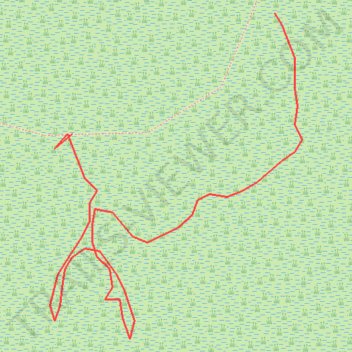
Disa River segment
- Distance: 0.4 Km
- Elevation gain: 1 m
- Maximum elevation: 4 m
- Elevation loss: 0 m
- Minimum elevation: 3 m
- Moving time: 7 m 2 s
- Moving speed: 3.1 Km/h
- Maximum speed: 21.9 Km/h
- Total time: 22 m 51 s
- Global speed: 1.0 Km/h
Interactive trail map
Make a donation
Gear up for your next adventure:
As an Amazon Associate, this site earns from qualifying purchases at no extra cost to you.
Trail profile
- Distance: 0.4 Km
- Elevation gain: 1 m
- Maximum elevation: 4 m
- Elevation loss: 0 m
- Minimum elevation: 3 m
- Moving time: 7 m 2 s
- Moving speed: 3.1 Km/h
- Maximum speed: 21.9 Km/h
- Total time: 22 m 51 s
- Global speed: 1.0 Km/h
Make a donation
Gear up for your next adventure:
As an Amazon Associate, this site earns from qualifying purchases at no extra cost to you.
About this trail
Name: Tracked with OSMTracker for Android™ trail, distance, elevation, map, profile, GPS track
Coordinates: -34.03777 18.35261 -34.03669 18.35362
Make a donation
Gear up for your next adventure:
As an Amazon Associate, this site earns from qualifying purchases at no extra cost to you.
Other hiking, mountain biking, running and outdoor activity trails
Click on a trail to view its statistics, map and profile.
Simon's Town - Cape Town
South Africa > Western Cape > City of Cape Town > Simon's Town
#Bike
Distance: 53.9 Km • Elevation gain: 1,127 m • Maximum elevation: 184 m
Tracked with OSMTracker for Android™
South Africa > Western Cape > City of Cape Town > Hout Bay > Sea Glade
Disa paths
Distance: 1.7 Km • Elevation gain: 21 m • Maximum elevation: 20 m