
Hike up Emma Lake A800 Trail
- Distance: 5.7 Km
- Elevation gain: 1,164 m
- Maximum elevation: 1,352 m
- Elevation loss: 20 m
- Minimum elevation: 195 m
- Moving time: 2 h 42 m
- Moving speed: 2.1 Km/h
- Maximum speed: 7.9 Km/h
- Total time: 4 h 14 m
- Global speed: 1.4 Km/h
Interactive trail map
Trail profile
- Distance: 5.7 Km
- Elevation gain: 1,164 m
- Maximum elevation: 1,352 m
- Elevation loss: 20 m
- Minimum elevation: 195 m
- Moving time: 2 h 42 m
- Moving speed: 2.1 Km/h
- Maximum speed: 7.9 Km/h
- Total time: 4 h 14 m
- Global speed: 1.4 Km/h
About this trail
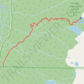
Name: Hike up Emma Lake A800 Trail trail, distance, elevation, map, profile, GPS track
Coordinates: 50.11619 -124.20394 50.13237 -124.16366
Topography: Area A (Malaspina/Toba) topographic map, elevation, terrain