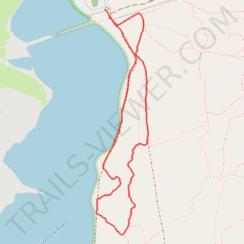
Bluff Point State Park loop hike
- Distance: 2.0 Km
- Elevation gain: 39 m
- Maximum elevation: 26 m
- Elevation loss: 38 m
- Minimum elevation: 1 m
- Moving time: 25 m 55 s
- Moving speed: 4.7 Km/h
- Maximum speed: 6.5 Km/h
- Total time: 26 m 34 s
- Global speed: 4.6 Km/h
Interactive trail map
Trail profile
- Distance: 2.0 Km
- Elevation gain: 39 m
- Maximum elevation: 26 m
- Elevation loss: 38 m
- Minimum elevation: 1 m
- Moving time: 25 m 55 s
- Moving speed: 4.7 Km/h
- Maximum speed: 6.5 Km/h
- Total time: 26 m 34 s
- Global speed: 4.6 Km/h
About this trail
Name: Bluff Point State Park loop hike trail, distance, elevation, map, profile, GPS track
Coordinates: 41.32867 -72.03382 41.33574 -72.03166
Other hiking, mountain biking, running and outdoor activity trails
Click on a trail to view its statistics, map and profile.
Bluff Point Loop Trail in Bluff Point State Park
United States > Connecticut > Southeastern Connecticut Planning Region > Groton > Poquonock Bridge
Hiking the Bluff Point Loop offers a delightful blend of coastal scenery and serene woodlands. As you traverse the well-marked paths, you can enjoy stunning views of Long Island Sound, particularly from the bluff where the landscape opens up dramatically. The trail is popular for its diverse wildlife, making…
Distance: 5.8 Km • Elevation gain: 61 m • Maximum elevation: 38 m