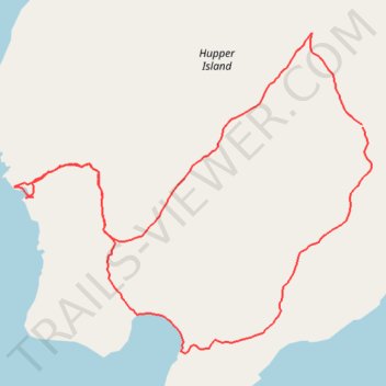
Hupper Island south side
- Distance: 3.1 Km
- Elevation gain: 49 m
- Maximum elevation: 28 m
- Elevation loss: 49 m
- Minimum elevation: 0 m
- Moving time: 48 m 40 s
- Moving speed: 3.8 Km/h
- Maximum speed: 7.3 Km/h
- Total time: 1 h 4 m
- Global speed: 2.9 Km/h
Interactive trail map
Trail profile
- Distance: 3.1 Km
- Elevation gain: 49 m
- Maximum elevation: 28 m
- Elevation loss: 49 m
- Minimum elevation: 0 m
- Moving time: 48 m 40 s
- Moving speed: 3.8 Km/h
- Maximum speed: 7.3 Km/h
- Total time: 1 h 4 m
- Global speed: 2.9 Km/h
About this trail
Name: Hupper Island south side trail, distance, elevation, map, profile, GPS track
Start: 12, Hupper Island, Saint George, Knox County, Maine, 04855, United States (43.92048 -69.26886)
End: 12, Hupper Island, Saint George, Knox County, Maine, 04855, United States (43.92054 -69.26889)
Coordinates: 43.91561 -69.27929 43.92252 -69.26861