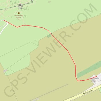
Housesteads Link
Connecting walk between Hadrian's Wall Path and the car park at Housesteads
- Distance: 0.6 Km
- Elevation gain: 11 m
- Maximum elevation: 252 m
- Elevation loss: 37 m
- Minimum elevation: 214 m
Interactive trail map
Trail profile
- Distance: 0.6 Km
- Elevation gain: 11 m
- Maximum elevation: 252 m
- Elevation loss: 37 m
- Minimum elevation: 214 m
About this trail
Name: Housesteads Link trail, distance, elevation, map, profile, GPS track
Coordinates: 55.00966 -2.33089 55.01225 -2.32396