Woodpecker Hill Loop Trail
Afternoon Trail Run
- Distance: 2.3 Km
- Elevation gain: 47 m
- Maximum elevation: 300 m
- Elevation loss: 46 m
- Minimum elevation: 260 m
- Moving time: 17 m 59 s
- Moving speed: 7.6 Km/h
- Maximum speed: 12.5 Km/h
- Total time: 18 m 36 s
- Global speed: 7.4 Km/h
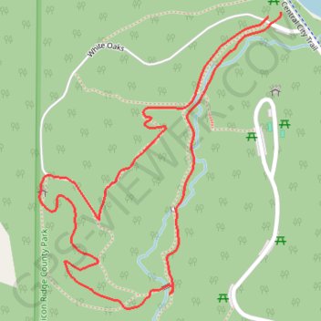
Interactive trail map
Trail profile
- Distance: 2.3 Km
- Elevation gain: 47 m
- Maximum elevation: 300 m
- Elevation loss: 46 m
- Minimum elevation: 260 m
- Moving time: 17 m 59 s
- Moving speed: 7.6 Km/h
- Maximum speed: 12.5 Km/h
- Total time: 18 m 36 s
- Global speed: 7.4 Km/h
About this trail
Name: Woodpecker Hill Loop Trail trail, distance, elevation, map, profile, GPS track
Start: White Oak Shelter, White Oaks, Linn County, Iowa, United States (42.21600 -91.54286)
End: Service drive, Linn County, Iowa, United States (42.21589 -91.54318)
Coordinates: 42.21042 -91.54898 42.21600 -91.54286