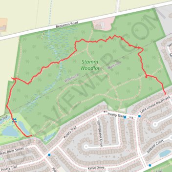
Stamm Woodlot
- Distance: 1.7 Km
- Elevation gain: 18 m
- Maximum elevation: 368 m
- Elevation loss: 15 m
- Minimum elevation: 357 m
- Moving time: 33 m 27 s
- Moving speed: 3.0 Km/h
- Maximum speed: 9.7 Km/h
- Total time: 39 m 24 s
- Global speed: 2.5 Km/h
Interactive trail map
Trail profile
- Distance: 1.7 Km
- Elevation gain: 18 m
- Maximum elevation: 368 m
- Elevation loss: 15 m
- Minimum elevation: 357 m
- Moving time: 33 m 27 s
- Moving speed: 3.0 Km/h
- Maximum speed: 9.7 Km/h
- Total time: 39 m 24 s
- Global speed: 2.5 Km/h
About this trail
Name: Stamm Woodlot trail, distance, elevation, map, profile, GPS track
Coordinates: 43.49163 -80.58968 43.49612 -80.57996
Topography: Waterloo topographic map, elevation, terrain