2014-06-22 14:03:54
- Distance: 42.3 Km
- Elevation gain: 2,722 m
- Maximum elevation: 3,421 m
- Elevation loss: 2,729 m
- Minimum elevation: 1,701 m
- Moving time: 14 h 48 m
- Moving speed: 2.9 Km/h
- Maximum speed: 7.8 Km/h
- Total time: 1 d 5 h
- Global speed: 1.4 Km/h
Interactive trail map
Trail profile
- Distance: 42.3 Km
- Elevation gain: 2,722 m
- Maximum elevation: 3,421 m
- Elevation loss: 2,729 m
- Minimum elevation: 1,701 m
- Moving time: 14 h 48 m
- Moving speed: 2.9 Km/h
- Maximum speed: 7.8 Km/h
- Total time: 1 d 5 h
- Global speed: 1.4 Km/h
About this trail
Name: 2014-06-22 14:03:54 trail, distance, elevation, map, profile, GPS track
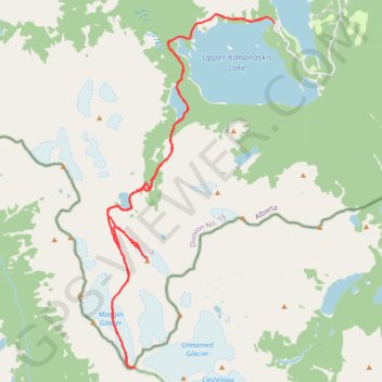
Start: Three Isle Lake Trail, Kananaskis Improvement District, Alberta, Canada (50.63307 -115.14563)
End: North Interlakes Loop Road, Kananaskis Improvement District, Alberta, Canada (50.63186 -115.14002)
Coordinates: 50.52832 -115.21929 50.63452 -115.14002
Topography: Kananaskis Improvement District topographic map, elevation, terrain