
Red Trillium Loop at Rock Run Nature Preserve
- Distance: 5.3 Km
- Elevation gain: 229 m
- Maximum elevation: 315 m
- Elevation loss: 230 m
- Minimum elevation: 167 m
- Moving time: 1 h 21 m
- Moving speed: 3.9 Km/h
- Maximum speed: 14.2 Km/h
- Total time: 1 h 28 m
- Global speed: 3.6 Km/h
Interactive trail map
Trail profile
- Distance: 5.3 Km
- Elevation gain: 229 m
- Maximum elevation: 315 m
- Elevation loss: 230 m
- Minimum elevation: 167 m
- Moving time: 1 h 21 m
- Moving speed: 3.9 Km/h
- Maximum speed: 14.2 Km/h
- Total time: 1 h 28 m
- Global speed: 3.6 Km/h
About this trail
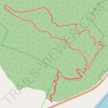
Name: Red Trillium Loop at Rock Run Nature Preserve trail, distance, elevation, map, profile, GPS track
Start: Red Trillium Loop, Green Township, Adams County, Ohio, 41179, United States (38.60783 -83.28353)
Coordinates: 38.60757 -83.28911 38.61680 -83.27696