Trail Through Time Loop in Pickle Springs Natural Area
The Trail Through Time Loop offers an engaging journey through diverse geological and natural features. Along the route, hikers will encounter dramatic sandstone hoodoos, unique rock formations like the Cauliflower Rocks, and striking landmarks such as the Double Arch and The Slot canyon. The trail also passes through lush, moss-covered gorges, scenic creek crossings, and beautiful sandstone bluffs, including Owl’s Den Bluff. The path is a rewarding exploration for those interested in both geological wonders and rich natural beauty. #Hiking #Loop #Rock #Forest #Nature
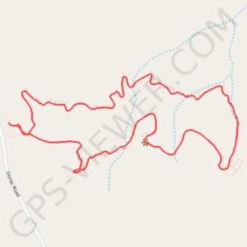
- Distance: 2.9 Km
- Elevation gain: 72 m
- Maximum elevation: 315 m
- Elevation loss: 70 m
- Minimum elevation: 270 m
- Moving time: 57 m 10 s
- Moving speed: 3.1 Km/h
- Maximum speed: 6.8 Km/h
- Total time: 1 h 4 m
- Global speed: 2.7 Km/h
Interactive trail map
Trail profile
- Distance: 2.9 Km
- Elevation gain: 72 m
- Maximum elevation: 315 m
- Elevation loss: 70 m
- Minimum elevation: 270 m
- Moving time: 57 m 10 s
- Moving speed: 3.1 Km/h
- Maximum speed: 6.8 Km/h
- Total time: 1 h 4 m
- Global speed: 2.7 Km/h
About this trail
Name: Trail Through Time Loop in Pickle Springs Natural Area trail, distance, elevation, map, profile, GPS track
End: 22233, Dorlac Road, Ste. Genevieve County, Missouri, 63640, United States (37.80180 -90.30154)
Coordinates: 37.80023 -90.30154 37.80332 -90.29244