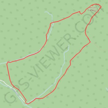
Import a GPX file

Mount Carleton

#Hiking #Loop

  • Distance: 9.1 Km
  • Elevation gain: 394 m
  • Maximum elevation: 792 m
  • Elevation loss: 395 m
  • Minimum elevation: 403 m

Interactive trail map

Trail profile

  • Distance: 9.1 Km
  • Elevation gain: 394 m
  • Maximum elevation: 792 m
  • Elevation loss: 395 m
  • Minimum elevation: 403 m

About this trail

Other hiking, mountain biking, running and outdoor activity trails

Click on a trail to view its statistics, map and profile.

Sagamook Mountain - Mount Carleton

Canada > New Brunswick > Addington Parish

#Hiking #Loop

Distance: 15.3 Km • Elevation gain: 819 m • Maximum elevation: 795 m

Gear up for your next adventure:

🎒Hiking Backpack - Lightweight and ergonomic backpacks for day hikes or multi-day treks
🧥Waterproof Pants - Keep dry during rainy hiking conditions
🧭GPS Handheld Device - Reliable GPS navigation for outdoor adventures
🧢Hiking Sun Hat - Wide-brimmed protection for exposed mountain ridges
🧦Outdoor Socks - Durable socks designed for hiking and outdoor sports

As an Amazon Associate, this site earns from qualifying purchases at no extra cost to you.