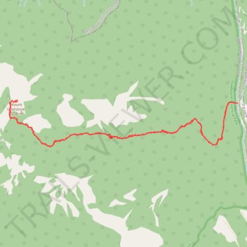
Mount Gladstone hiking trail
- Distance: 14.2 Km
- Elevation gain: 1,112 m
- Maximum elevation: 2,244 m
- Elevation loss: 1,110 m
- Minimum elevation: 1,160 m
- Moving time: 4 h 51 m
- Moving speed: 2.9 Km/h
- Maximum speed: 20.4 Km/h
- Total time: 7 h 29 m
- Global speed: 1.9 Km/h
Interactive trail map
Trail profile
- Distance: 14.2 Km
- Elevation gain: 1,112 m
- Maximum elevation: 2,244 m
- Elevation loss: 1,110 m
- Minimum elevation: 1,160 m
- Moving time: 4 h 51 m
- Moving speed: 2.9 Km/h
- Maximum speed: 20.4 Km/h
- Total time: 7 h 29 m
- Global speed: 1.9 Km/h
About this trail
Name: Mount Gladstone hiking trail trail, distance, elevation, map, profile, GPS track
Coordinates: 49.22906 -118.18664 49.23597 -118.13448
Topography: Area C (Christina Lake) topographic map, elevation, terrain
Other hiking, mountain biking, running and outdoor activity trails
Click on a trail to view its statistics, map and profile.