Tremper Mountain
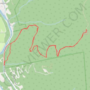
Hike to the Tremper Mountain Fire Tower via Phoenicia Trail in the Phoenicia - Mount Tobias Wild Forest. #Hiking #Mountain #Nature #Forest
- Distance: 9.9 Km
- Elevation gain: 629 m
- Maximum elevation: 824 m
- Elevation loss: 626 m
- Minimum elevation: 233 m
- Moving time: 2 h 30 m
- Moving speed: 4.0 Km/h
- Maximum speed: 25.9 Km/h
- Total time: 2 h 40 m
- Global speed: 3.7 Km/h
Interactive trail map
Trail profile
- Distance: 9.9 Km
- Elevation gain: 629 m
- Maximum elevation: 824 m
- Elevation loss: 626 m
- Minimum elevation: 233 m
- Moving time: 2 h 30 m
- Moving speed: 4.0 Km/h
- Maximum speed: 25.9 Km/h
- Total time: 2 h 40 m
- Global speed: 3.7 Km/h
About this trail
Name: Tremper Mountain trail, distance, elevation, map, profile, GPS track
Coordinates: 42.06619 -74.30354 42.07553 -74.27770