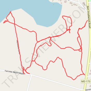
Weinberg Park
- Distance: 4.7 Km
- Elevation gain: 39 m
- Maximum elevation: 20 m
- Elevation loss: 39 m
- Minimum elevation: 2 m
- Moving time: 1 h 14 m
- Moving speed: 3.8 Km/h
- Maximum speed: 7.1 Km/h
- Total time: 1 h 24 m
- Global speed: 3.3 Km/h
Interactive trail map
Trail profile
- Distance: 4.7 Km
- Elevation gain: 39 m
- Maximum elevation: 20 m
- Elevation loss: 39 m
- Minimum elevation: 2 m
- Moving time: 1 h 14 m
- Moving speed: 3.8 Km/h
- Maximum speed: 7.1 Km/h
- Total time: 1 h 24 m
- Global speed: 3.3 Km/h
About this trail
Name: Weinberg Park trail, distance, elevation, map, profile, GPS track
Coordinates: 39.15192 -76.48950 39.15699 -76.48144