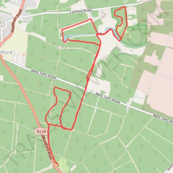
Lynford Walk
- Distance: 10.1 Km
- Elevation gain: 70 m
- Maximum elevation: 41 m
- Elevation loss: 69 m
- Minimum elevation: 16 m
- Moving time: 2 h 52 m
- Moving speed: 3.5 Km/h
- Maximum speed: 10.7 Km/h
- Total time: 3 h 3 m
- Global speed: 3.3 Km/h
Interactive trail map
Trail profile
- Distance: 10.1 Km
- Elevation gain: 70 m
- Maximum elevation: 41 m
- Elevation loss: 69 m
- Minimum elevation: 16 m
- Moving time: 2 h 52 m
- Moving speed: 3.5 Km/h
- Maximum speed: 10.7 Km/h
- Total time: 3 h 3 m
- Global speed: 3.3 Km/h
About this trail
Name: Lynford Walk trail, distance, elevation, map, profile, GPS track
Coordinates: 52.49384 0.66682 52.51548 0.68486