
North Rim Trail
- Distance: 1.7 Km
- Elevation gain: 75 m
- Maximum elevation: 365 m
- Elevation loss: 79 m
- Minimum elevation: 294 m
- Moving time: 15 m 44 s
- Moving speed: 6.6 Km/h
- Maximum speed: 14.1 Km/h
- Total time: 15 m 44 s
- Global speed: 6.6 Km/h
Interactive trail map
Trail profile
- Distance: 1.7 Km
- Elevation gain: 75 m
- Maximum elevation: 365 m
- Elevation loss: 79 m
- Minimum elevation: 294 m
- Moving time: 15 m 44 s
- Moving speed: 6.6 Km/h
- Maximum speed: 14.1 Km/h
- Total time: 15 m 44 s
- Global speed: 6.6 Km/h
About this trail
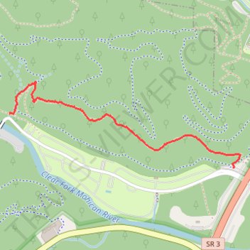
Name: North Rim Trail trail, distance, elevation, map, profile, GPS track
Start: Hemlock Gorge Trail, Hanover Township, Ashland County, Ohio, United States (40.61268 -82.27207)
Coordinates: 40.61014 -82.27207 40.61416 -82.25782