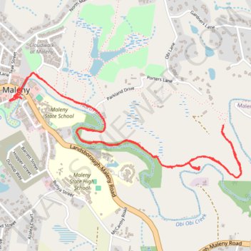
Maleny boardwalk trail trace
- Distance: 7.2 Km
- Elevation gain: 89 m
- Maximum elevation: 417 m
- Elevation loss: 89 m
- Minimum elevation: 384 m
- Moving time: 41 m 33 s
- Moving speed: 10.5 Km/h
- Maximum speed: 36.1 Km/h
- Total time: 1 h 10 m
- Global speed: 6.2 Km/h
Interactive trail map
Trail profile
- Distance: 7.2 Km
- Elevation gain: 89 m
- Maximum elevation: 417 m
- Elevation loss: 89 m
- Minimum elevation: 384 m
- Moving time: 41 m 33 s
- Moving speed: 10.5 Km/h
- Maximum speed: 36.1 Km/h
- Total time: 1 h 10 m
- Global speed: 6.2 Km/h
About this trail
Name: Maleny boardwalk trail trace trail, distance, elevation, map, profile, GPS track
Start: Coral Street, Maleny, Sunshine Coast Regional, Queensland, 4552, Australia (-26.75909 152.85313)
Coordinates: -26.76484 152.85260 -26.75739 152.87104