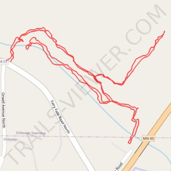
Fairy Falls trail
- Distance: 2.4 Km
- Elevation gain: 73 m
- Maximum elevation: 255 m
- Elevation loss: 74 m
- Minimum elevation: 213 m
- Moving time: 29 m 22 s
- Moving speed: 5.0 Km/h
- Maximum speed: 16.2 Km/h
- Total time: 30 m 54 s
- Global speed: 4.7 Km/h
Interactive trail map
Trail profile
- Distance: 2.4 Km
- Elevation gain: 73 m
- Maximum elevation: 255 m
- Elevation loss: 74 m
- Minimum elevation: 213 m
- Moving time: 29 m 22 s
- Moving speed: 5.0 Km/h
- Maximum speed: 16.2 Km/h
- Total time: 30 m 54 s
- Global speed: 4.7 Km/h
About this trail
Name: Fairy Falls trail trail, distance, elevation, map, profile, GPS track
Coordinates: 45.07914 -92.80769 45.08181 -92.80254
Other hiking, mountain biking, running and outdoor activity trails
Click on a trail to view its statistics, map and profile.
Brown's Creek State Trail
United States > Minnesota > Washington County > Stillwater
Distance: 28.3 Km • Elevation gain: 218 m • Maximum elevation: 311 m