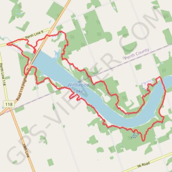
Wildwood Lake
Interactive trail map
Trail profile
- Distance: 21.6 Km
- Elevation gain: 276 m
- Maximum elevation: 358 m
- Elevation loss: 276 m
- Minimum elevation: 314 m
About this trail
Name: Wildwood Lake trail, distance, elevation, map, profile, GPS track
Start: 2402, Wildwood Trail 🟢, Perth South, Perth County, Ontario, N4X 1B3, Canada (43.26845 -81.06839)
End: 2402, Wildwood Trail 🟢, Perth South, Perth County, Ontario, N4X 1B3, Canada (43.26845 -81.06839)
Coordinates: 43.23721 -81.08627 43.26982 -81.02115
Topography: Perth South topographic map, elevation, terrain