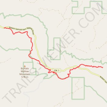
Ouachita National Recreation Trail from Potato Hill Vista to Rock Garden Shelter
- Distance: 11.3 Km
- Elevation gain: 238 m
- Maximum elevation: 667 m
- Elevation loss: 398 m
- Minimum elevation: 399 m
- Moving time: 2 h 59 m
- Moving speed: 3.8 Km/h
- Maximum speed: 5.8 Km/h
- Total time: 3 h 16 m
- Global speed: 3.5 Km/h
Interactive trail map
Trail profile
- Distance: 11.3 Km
- Elevation gain: 238 m
- Maximum elevation: 667 m
- Elevation loss: 398 m
- Minimum elevation: 399 m
- Moving time: 2 h 59 m
- Moving speed: 3.8 Km/h
- Maximum speed: 5.8 Km/h
- Total time: 3 h 16 m
- Global speed: 3.5 Km/h
About this trail
Name: Ouachita National Recreation Trail from Potato Hill Vista to Rock Garden Shelter trail, distance, elevation, map, profile, GPS track
Start: Robert Samuel Kerr Skyline Drive, LeFlore County, Oklahoma, United States (34.79528 -94.92550)
End: Ouachita National Recreation Trail, LeFlore County, Oklahoma, United States (34.77188 -94.85413)
Coordinates: 34.76503 -94.92550 34.79545 -94.85413