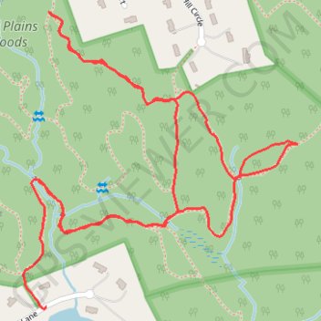
Thank you for supporting this site ❤️
Make a donation
Make a donation
Gear up for your next adventure:
As an Amazon Associate, this site earns from qualifying purchases at no extra cost to you.
Nut Plains Guilford
- Distance: 3.0 Km
- Elevation gain: 53 m
- Maximum elevation: 47 m
- Elevation loss: 60 m
- Minimum elevation: 8 m
- Moving time: 53 m 58 s
- Moving speed: 3.3 Km/h
- Maximum speed: 5.3 Km/h
- Total time: 1 h 14 m
- Global speed: 2.4 Km/h
Interactive trail map
Thank you for supporting this site ❤️
Make a donation
Make a donation
Gear up for your next adventure:
As an Amazon Associate, this site earns from qualifying purchases at no extra cost to you.
Trail profile
- Distance: 3.0 Km
- Elevation gain: 53 m
- Maximum elevation: 47 m
- Elevation loss: 60 m
- Minimum elevation: 8 m
- Moving time: 53 m 58 s
- Moving speed: 3.3 Km/h
- Maximum speed: 5.3 Km/h
- Total time: 1 h 14 m
- Global speed: 2.4 Km/h
Thank you for supporting this site ❤️
Make a donation
Make a donation
Gear up for your next adventure:
As an Amazon Associate, this site earns from qualifying purchases at no extra cost to you.
About this trail
Name: Nut Plains Guilford trail, distance, elevation, map, profile, GPS track
Coordinates: 41.32073 -72.67548 41.32616 -72.66881
Thank you for supporting this site ❤️
Make a donation
Make a donation
Gear up for your next adventure:
As an Amazon Associate, this site earns from qualifying purchases at no extra cost to you.