Make a donation
Gear up for your next adventure:
As an Amazon Associate, this site earns from qualifying purchases at no extra cost to you.
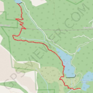
Mason Trail, Mc Reynolds Reservoir, Mason Reservoir, Boehmer Reservoir, South Slope Recreation Area, Pikes Peak, Colorado
- Distance: 15.9 Km
- Elevation gain: 350 m
- Maximum elevation: 3,492 m
- Elevation loss: 351 m
- Minimum elevation: 3,311 m
- Moving time: 4 h 4 m
- Moving speed: 3.9 Km/h
- Maximum speed: 9.3 Km/h
- Total time: 5 h 6 m
- Global speed: 3.1 Km/h
Interactive trail map
Make a donation
Gear up for your next adventure:
As an Amazon Associate, this site earns from qualifying purchases at no extra cost to you.
Trail profile
- Distance: 15.9 Km
- Elevation gain: 350 m
- Maximum elevation: 3,492 m
- Elevation loss: 351 m
- Minimum elevation: 3,311 m
- Moving time: 4 h 4 m
- Moving speed: 3.9 Km/h
- Maximum speed: 9.3 Km/h
- Total time: 5 h 6 m
- Global speed: 3.1 Km/h
Make a donation
Gear up for your next adventure:
As an Amazon Associate, this site earns from qualifying purchases at no extra cost to you.
About this trail
Name: Mason Trail, Mc Reynolds Reservoir, Mason Reservoir, Boehmer Reservoir, South Slope Recreation Area, Pikes Peak, Colorado trail, distance, elevation, map, profile, GPS track
Start: City Water Department Roads, Teller County, Colorado, United States (38.77550 -105.00963)
End: City Water Department Roads, Teller County, Colorado, United States (38.77552 -105.00963)
Coordinates: 38.77531 -105.04228 38.80794 -105.00934
Make a donation
Gear up for your next adventure:
As an Amazon Associate, this site earns from qualifying purchases at no extra cost to you.