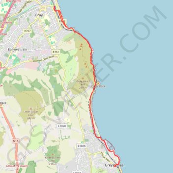
Bray - Greystones
- Distance: 18.0 Km
- Elevation gain: 511 m
- Maximum elevation: 74 m
- Elevation loss: 511 m
- Minimum elevation: 0 m
Interactive trail map
Trail profile
- Distance: 18.0 Km
- Elevation gain: 511 m
- Maximum elevation: 74 m
- Elevation loss: 511 m
- Minimum elevation: 0 m
About this trail
Name: Bray - Greystones trail, distance, elevation, map, profile, GPS track
Coordinates: 53.14418 -6.10109 53.20458 -6.05998