Mount Umunhum
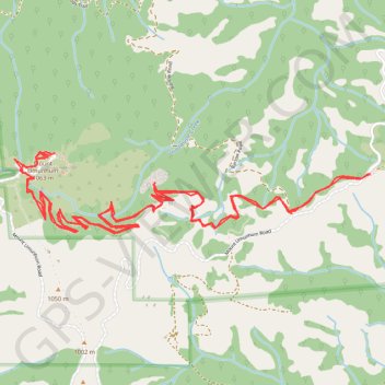
Starting at Bald Mountain Parking Area in Sierra Azul Open Space Preserve, the route follows Mount Umunhum Trail westward through mixed chaparral, knobcone pine, coast live oak, California bay, and madrone, with openings toward Santa Clara Valley and the surrounding ridges.
The itinerary then passes the Guadalupe Creek headwaters and Guadalupe Creek Overlook, continuing along the upper mountain approach as the woodland gives way to broader summit views.
The hike finishes on Mount Umunhum’s restored summit, where interpretive features, the ceremonial circle, sweeping views across the Bay Area and toward the ocean, and the preserved former Air Force radar tower give the route a distinctive blend of natural scenery, Indigenous heritage, and Cold War history.
#Hiking #Mountain #Nature #Forest #Overlook #Summit #Views
- Distance: 12.1 Km
- Elevation gain: 633 m
- Maximum elevation: 1,046 m
- Elevation loss: 634 m
- Minimum elevation: 687 m
- Moving time: 2 h 39 m
- Moving speed: 4.5 Km/h
- Maximum speed: 8.9 Km/h
- Total time: 2 h 57 m
- Global speed: 4.1 Km/h
Interactive trail map
Trail profile
- Distance: 12.1 Km
- Elevation gain: 633 m
- Maximum elevation: 1,046 m
- Elevation loss: 634 m
- Minimum elevation: 687 m
- Moving time: 2 h 39 m
- Moving speed: 4.5 Km/h
- Maximum speed: 8.9 Km/h
- Total time: 2 h 57 m
- Global speed: 4.1 Km/h
About this trail
Name: Mount Umunhum trail, distance, elevation, map, profile, GPS track
End: Bald Mountain Trail, Santa Clara County, California, United States (37.15950 -121.87564)
Coordinates: 37.15613 -121.90088 37.16075 -121.87564
Other hiking, mountain biking, running and outdoor activity trails
Click on a trail to view its statistics, map and profile.
Mount Umunhum Trail via Guadalupe Creek Overlook in Sierra Azul Open Space Preserve
United States > California > Santa Clara County
The Mount Umunhum Trail via the Guadalupe Creek Overlook offers hikers a varied and rewarding experience, showcasing a range of ecosystems from oak woodlands to chaparral scrub. Along the route, visitors are treated to expansive views of the Santa Clara Valley and surrounding mountain ranges, with notable…
Distance: 12.7 Km • Elevation gain: 598 m • Maximum elevation: 1,048 m