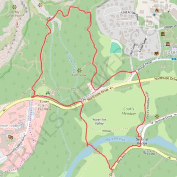
Lower Yosemite Fall and Cook's Meadow Trails Loop
Starting near Yosemite Valley Lodge, the route enters the Lower Yosemite Fall Trail, follows Yosemite Creek through shaded valley woodland, and reaches the footbridge and close viewpoint beneath Lower Yosemite Fall.
It then returns toward Northside Drive and crosses into Cook’s Meadow, where open meadow paths reveal broad views of Yosemite Falls, Half Dome, Glacier Point, Sentinel Rock, and Royal Arches.
The loop continues toward the Merced River and Sentinel Bridge before curving back through the Valley Loop corridor, offering an easy scenic introduction to Yosemite Valley’s waterfalls, meadows, riverbanks, forest edges, and granite walls.
#Hiking #Loop #Mountain #Yosemite #Meadow #Waterfall #River #Forest #Valley #Granite #Nature
- Distance: 3.3 Km
- Elevation gain: 75 m
- Maximum elevation: 1,252 m
- Elevation loss: 75 m
- Minimum elevation: 1,204 m
- Moving time: 50 m 28 s
- Moving speed: 3.9 Km/h
- Maximum speed: 7.8 Km/h
- Total time: 54 m 38 s
- Global speed: 3.6 Km/h
Interactive trail map
Trail profile
- Distance: 3.3 Km
- Elevation gain: 75 m
- Maximum elevation: 1,252 m
- Elevation loss: 75 m
- Minimum elevation: 1,204 m
- Moving time: 50 m 28 s
- Moving speed: 3.9 Km/h
- Maximum speed: 7.8 Km/h
- Total time: 54 m 38 s
- Global speed: 3.6 Km/h
About this trail
Name: Lower Yosemite Fall and Cook's Meadow Trails Loop trail, distance, elevation, map, profile, GPS track
Coordinates: 37.74187 -119.59713 37.75060 -119.58941
Other hiking, mountain biking, running and outdoor activity trails
Click on a trail to view its statistics, map and profile.
Upper Yosemite Fall, Yosemite Point, Oh My Gosh Point and Columbia Rock
United States > California > Mariposa County > Yosemite Village > Yosemite Lodge
Starting near Yosemite Lodge and the Camp Four area, this demanding route climbs the Upper Yosemite Fall Trail through oak woodland and granite switchbacks, quickly rising above Yosemite Valley toward Columbia Rock, where broad views open over the valley floor, Merced River corridor, Half Dome, and surrounding…
Distance: 14.9 Km • Elevation gain: 2,437 m • Maximum elevation: 2,143 m
Yosemite Valley Loop
United States > California > Mariposa County > Yosemite Village
From Yosemite Village, the route slips into the Valley Loop Trail corridor, moving through the quieter village edge toward Yosemite Falls views before continuing west below the Three Brothers and into the open floor of Leidig Meadow, where forest, meadow grass, and the Merced River alternate along the way. The…
Distance: 14.9 Km • Elevation gain: 213 m • Maximum elevation: 1,240 m
Lower Yosemite Fall Trail and Cook's Meadow Trail Loop in Yosemite National Park
United States > California > Mariposa County > Yosemite Village > Yosemite Lodge
The combined Lower Yosemite Fall and Cook's Meadow Trails Loop in Yosemite National Park offer hikers breathtaking views of iconic landmarks. Along this easy, flat path, you'll encounter stunning vistas of Yosemite Falls, Half Dome, Sentinel Rock, and Glacier Point, all set against the serene backdrop of lush…
Distance: 3.1 Km • Elevation gain: 73 m • Maximum elevation: 1,251 m
Yosemite Point via Upper Yosemite Fall Trail in Yosemite National Park
United States > California > Mariposa County > Yosemite Lodge
The Upper Yosemite Falls Trail to Yosemite Point is a strenuous hike that offers hikers panoramic views of Yosemite Valley, including iconic landmarks such as Half Dome and the Cathedral Spires. Along the ascent, the trail provides close-up perspectives of the majestic Upper Yosemite Falls—one of the tallest…
Distance: 13.8 Km • Elevation gain: 1,775 m • Maximum elevation: 2,138 m
Yosemite North Dome Loop
United States > California > Mariposa County > Curry Village
Loop hike to North Dome via Lower Mirror Lake, Tenaya Creek, Valley Loop Trail, Snow Creek Trail, North Dome Trail, Upper Yosemite Fall Trail, Oh My Gosh Point and Columbia Rock in the Yosemite National Park. #Hiking #Loop #Mountain #Nature #Lake #Forest #Fall #Park #Yosemite
Distance: 32.0 Km • Elevation gain: 2,275 m • Maximum elevation: 2,484 m
Lower Yosemite Falls Trail in Yosemite National Park
United States > California > Mariposa County > Yosemite Village > Yosemite Lodge
Hiking the Lower Yosemite Falls Trail is a delightful experience for nature lovers of all ages! The paved path makes it accessible, and the breathtaking views of the waterfalls are especially spectacular in spring when the snowmelt creates a powerful flow. Plus, you can enjoy the tranquility of the surrounding…
Distance: 2.2 Km • Elevation gain: 60 m • Maximum elevation: 1,250 m