Walk up Mount Doongul
- Distance: 5.9 Km
- Elevation gain: 169 m
- Maximum elevation: 225 m
- Elevation loss: 27 m
- Minimum elevation: 79 m
- Moving time: 1 h 56 m
- Moving speed: 3.0 Km/h
- Maximum speed: 11.8 Km/h
- Total time: 2 h 56 m
- Global speed: 2.0 Km/h
Interactive trail map
Trail profile
- Distance: 5.9 Km
- Elevation gain: 169 m
- Maximum elevation: 225 m
- Elevation loss: 27 m
- Minimum elevation: 79 m
- Moving time: 1 h 56 m
- Moving speed: 3.0 Km/h
- Maximum speed: 11.8 Km/h
- Total time: 2 h 56 m
- Global speed: 2.0 Km/h
About this trail
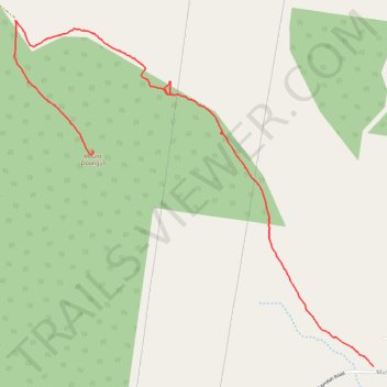
Name: Walk up Mount Doongul trail, distance, elevation, map, profile, GPS track
End: Doongul, Fraser Coast Regional, Queensland, Australia (-25.48704 152.34480)
Coordinates: -25.50149 152.33895 -25.47827 152.36561