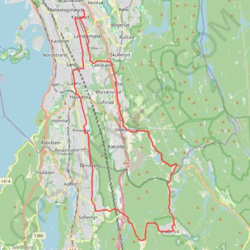
Directions from Østerliveien 25a, Oslo to Østerliveien 25a, Oslo
- Distance: 30.7 Km
- Elevation gain: 437 m
- Maximum elevation: 169 m
- Elevation loss: 437 m
- Minimum elevation: 62 m
Interactive trail map
Trail profile
- Distance: 30.7 Km
- Elevation gain: 437 m
- Maximum elevation: 169 m
- Elevation loss: 437 m
- Minimum elevation: 62 m
About this trail
Name: Directions from Østerliveien 25a, Oslo to Østerliveien 25a, Oslo trail, distance, elevation, map, profile, GPS track
Start: 18F, Østerliveien, Søndre Østli, Nordstrand, Oslo, 1185, Norway (59.88352 10.80945)
End: 18F, Østerliveien, Søndre Østli, Nordstrand, Oslo, 1185, Norway (59.88352 10.80945)
Coordinates: 59.78699 10.80130 59.88352 10.88756