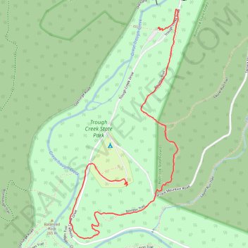
Trough Creek State Park
- Distance: 2.7 Km
- Elevation gain: 140 m
- Maximum elevation: 367 m
- Elevation loss: 105 m
- Minimum elevation: 255 m
- Moving time: 44 m 15 s
- Moving speed: 3.7 Km/h
- Maximum speed: 7.0 Km/h
- Total time: 57 m 35 s
- Global speed: 2.8 Km/h
Interactive trail map
Trail profile
- Distance: 2.7 Km
- Elevation gain: 140 m
- Maximum elevation: 367 m
- Elevation loss: 105 m
- Minimum elevation: 255 m
- Moving time: 44 m 15 s
- Moving speed: 3.7 Km/h
- Maximum speed: 7.0 Km/h
- Total time: 57 m 35 s
- Global speed: 2.8 Km/h
About this trail
Name: Trough Creek State Park trail, distance, elevation, map, profile, GPS track
Coordinates: 40.32175 -78.12979 40.33193 -78.12350