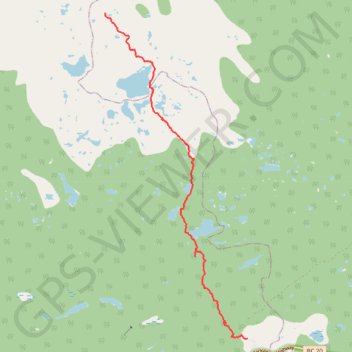
Rainbow Range Trail
- Distance: 9.4 Km
- Elevation gain: 49 m
- Maximum elevation: 1,866 m
- Elevation loss: 417 m
- Minimum elevation: 1,497 m
- Moving time: 2 h 18 m
- Moving speed: 4.1 Km/h
- Maximum speed: 64.2 Km/h
- Total time: 3 h 48 m
- Global speed: 2.5 Km/h
Interactive trail map
Trail profile
- Distance: 9.4 Km
- Elevation gain: 49 m
- Maximum elevation: 1,866 m
- Elevation loss: 417 m
- Minimum elevation: 1,497 m
- Moving time: 2 h 18 m
- Moving speed: 4.1 Km/h
- Maximum speed: 64.2 Km/h
- Total time: 3 h 48 m
- Global speed: 2.5 Km/h
About this trail
Name: Rainbow Range Trail trail, distance, elevation, map, profile, GPS track
Coordinates: 52.53492 -125.85564 52.59199 -125.81468
Topography: Area J (West Chilcotin) topographic map, elevation, terrain