Thank you for supporting this site ❤️
Make a donation
Make a donation
Gear up for your next adventure:
As an Amazon Associate, this site earns from qualifying purchases at no extra cost to you.
Pineapple Express
- Distance: 3.4 Km
- Elevation gain: 29 m
- Maximum elevation: 328 m
- Elevation loss: 31 m
- Minimum elevation: 300 m
- Moving time: 27 m 32 s
- Moving speed: 7.5 Km/h
- Maximum speed: 10.9 Km/h
- Total time: 27 m 32 s
- Global speed: 7.5 Km/h
Interactive trail map
Thank you for supporting this site ❤️
Make a donation
Make a donation
Gear up for your next adventure:
As an Amazon Associate, this site earns from qualifying purchases at no extra cost to you.
Trail profile
- Distance: 3.4 Km
- Elevation gain: 29 m
- Maximum elevation: 328 m
- Elevation loss: 31 m
- Minimum elevation: 300 m
- Moving time: 27 m 32 s
- Moving speed: 7.5 Km/h
- Maximum speed: 10.9 Km/h
- Total time: 27 m 32 s
- Global speed: 7.5 Km/h
Thank you for supporting this site ❤️
Make a donation
Make a donation
Gear up for your next adventure:
As an Amazon Associate, this site earns from qualifying purchases at no extra cost to you.
About this trail
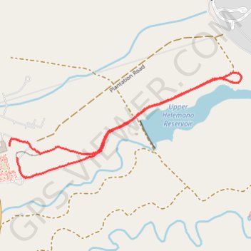
Name: Pineapple Express trail, distance, elevation, map, profile, GPS track
Coordinates: 21.52431 -158.03723 21.53023 -158.02323
Thank you for supporting this site ❤️
Make a donation
Make a donation
Gear up for your next adventure:
As an Amazon Associate, this site earns from qualifying purchases at no extra cost to you.