Import a GPX file

McCallum Pond

Hikeon the McCallum Trail from Thousands Palms Oasis to McCallum Pond in the Coachella Valley Preserve. #Hiking #Nature #Forest #Desert #Lake

  • Distance: 2.2 Km
  • Elevation gain: 58 m
  • Maximum elevation: 219 m
  • Elevation loss: 18 m
  • Minimum elevation: 167 m

Interactive trail map

Trail profile

  • Distance: 2.2 Km
  • Elevation gain: 58 m
  • Maximum elevation: 219 m
  • Elevation loss: 18 m
  • Minimum elevation: 167 m

About this trail

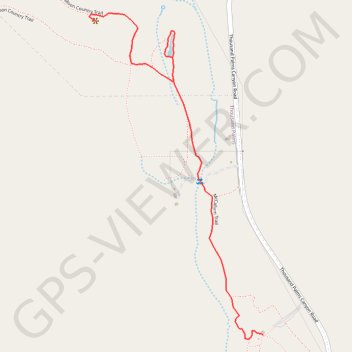
Name: McCallum Pond trail, distance, elevation, map, profile, GPS track

Start: McCallum Trail, Riverside County, California, United States (33.83749 -116.30934)

End: Moon Country Trail, Riverside County, California, United States (33.84846 -116.31635)

Coordinates: 33.83736 -116.31667 33.84876 -116.30934

Gear up for your next adventure:

🔭Compact Monocular - One-handed bird watching and trail spotting
🧣Merino Neck Gaiter - Protects against wind, sun, and cold at high altitudes
🩹Compact First Aid Kit - Pre-packed essentials for common trail injuries
🧦Hiking Socks - Moisture-wicking and comfortable socks for long hikes
Camping Tent - Weather-resistant tents suitable for 2 to 6 people

As an Amazon Associate, this site earns from qualifying purchases at no extra cost to you.