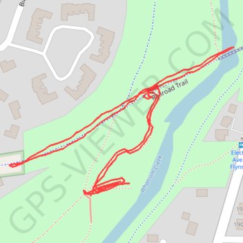
Railroad Trail
- Distance: 1.4 Km
- Elevation gain: 20 m
- Maximum elevation: 110 m
- Elevation loss: 24 m
- Minimum elevation: 97 m
- Moving time: 19 m 36 s
- Moving speed: 4.3 Km/h
- Maximum speed: 7.2 Km/h
- Total time: 20 m 12 s
- Global speed: 4.1 Km/h
Interactive trail map
Trail profile
- Distance: 1.4 Km
- Elevation gain: 20 m
- Maximum elevation: 110 m
- Elevation loss: 24 m
- Minimum elevation: 97 m
- Moving time: 19 m 36 s
- Moving speed: 4.3 Km/h
- Maximum speed: 7.2 Km/h
- Total time: 20 m 12 s
- Global speed: 4.1 Km/h
About this trail
Name: Railroad Trail trail, distance, elevation, map, profile, GPS track
Coordinates: 48.75530 -122.42637 48.75708 -122.42230