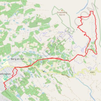
Groenberg Loop
- Distance: 30.2 Km
- Elevation gain: 689 m
- Maximum elevation: 450 m
- Elevation loss: 678 m
- Minimum elevation: 132 m
- Moving time: 1 h 52 m
- Moving speed: 16.1 Km/h
- Maximum speed: 48.1 Km/h
- Total time: 1 h 54 m
- Global speed: 15.9 Km/h
Interactive trail map
Trail profile
- Distance: 30.2 Km
- Elevation gain: 689 m
- Maximum elevation: 450 m
- Elevation loss: 678 m
- Minimum elevation: 132 m
- Moving time: 1 h 52 m
- Moving speed: 16.1 Km/h
- Maximum speed: 48.1 Km/h
- Total time: 1 h 54 m
- Global speed: 15.9 Km/h
About this trail
Name: Groenberg Loop trail, distance, elevation, map, profile, GPS track
Coordinates: -33.65465 19.01018 -33.59795 19.09096