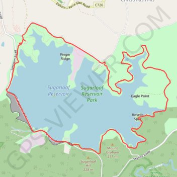
Sugarloaf Reservoir Park
Interactive trail map
Trail profile
- Distance: 15.2 Km
- Elevation gain: 308 m
- Maximum elevation: 267 m
- Elevation loss: 307 m
- Minimum elevation: 173 m
About this trail
Name: Sugarloaf Reservoir Park trail, distance, elevation, map, profile, GPS track
Coordinates: -37.68317 145.28809 -37.65744 145.32871
Other hiking, mountain biking, running and outdoor activity trails
Click on a trail to view its statistics, map and profile.
Tallarook - Eildon - Hurstbridge
Australia > Victoria > Tallarook
#Bike
Distance: 278.8 Km • Elevation gain: 4,897 m • Maximum elevation: 868 m