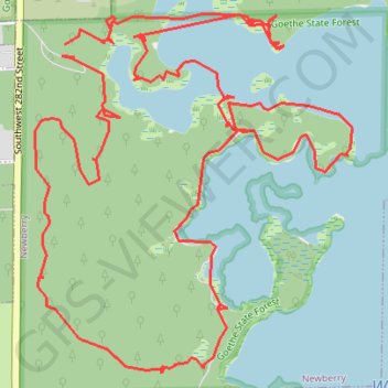
Goethe Forest and Watermelon Pond Loop
Interactive trail map
Trail profile
- Distance: 10.2 Km
- Elevation gain: 12 m
- Maximum elevation: 24 m
- Elevation loss: 12 m
- Minimum elevation: 19 m
About this trail
Name: Goethe Forest and Watermelon Pond Loop trail, distance, elevation, map, profile, GPS track
Start: Southwest 282nd Street, Newberry, Alachua County, Florida, United States (29.56476 -82.63755)
End: Southwest 282nd Street, Newberry, Alachua County, Florida, United States (29.56427 -82.63712)
Coordinates: 29.55193 -82.63885 29.56592 -82.62464